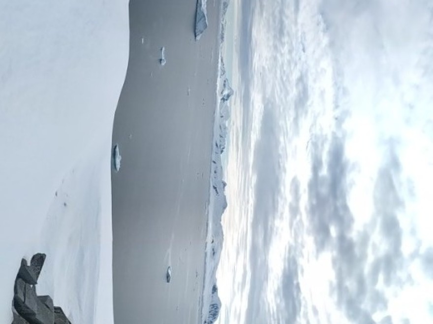
↑南極半島 嘿 說你倆呢
↑南極半島 面無表情
↑南極半島 獃
↑南極半島 也不知道叫啥呢
南極半島有用島的一大群金圖企鵝南極半島跑了跑了 不和你玩了南極半島滑行、蹦才是我的絕活南極半島看我企鵝高速路南極半島水中嬉戲,企鵝也是愛乾凈的
↑南極半島 全景x1
↑南極半島 有用島全景
↑南極半島 有用島全景x2
南極半島 陰晴不定的一天D8 12月10日 上午登陸夏古港(Port Charcot),中午穿越 利馬 水道(Lemaire Channel),下午登陸彼得曼島(Petermann Island),預告下今日有彩蛋!!!
查科特港(夏古港)位於布斯島(原名萬德爾島)的北部海岸。它是由Jean-Baptiste Charcot在1904年發現的,並以他父親的名字命名。1904年的冬天,夏科特號的船員就在附近度過。他們的船“ 法國 號”(Francais)靠岸停泊,船員們在船上睡覺,但他們建立了一個海岸觀測站,進行科學觀測,並作為一個潛在的應急避難所。Port Charcot lies on the northern coast of Booth Island (formerly named Wandel island). It was discovered by Jean-Baptiste Charcot in 1904 and named for his father. Charcot s crew spent the winter of 1904 close by. Their ship, Français, was moored and the men slept onboard but established a shore station for scientific observations and as a potential emergency shelter.
南緯65˚04’ , 西經63˚57’ (65˚04’ S, 63˚57’ W)
↑南極半島 首先還是企鵝來大頭陣,金圖企鵝,看這個姿勢應該是在孵蛋
↑南極半島 美麗的一片峽灣,天不晴有點小遺憾,峽灣里有鯨魚只不過沒拍到
↑南極半島 專心拍照的老爸
↑南極半島 浮冰,更有南極的味道了
↑南極半島 天有點晴朗啦
↑南極半島 南極的日常
↑南極半島 實際中這座山可美了,可惜了我的拍照技術
↑南極半島 嗯,稱之為聖山也不為過
↑南極半島 換個角度
↑南極半島 寧靜的港灣
↑南極半島 天亮了些 拍出來也好看些
↑南極半島 孤零零的小旗子
↑南極半島 企鵝的家
↑南極半島 髒兮兮的,身下的蛋也髒兮兮的
↑南極半島 老媽再一次的陷進來雪裡
↑南極半島 陷阱去出不來和小企鵝來個偶遇也不錯
↑南極半島 被賊鷗偷吃的企鵝蛋
↑南極半島 一家三口來個合影
↑南極半島 著名的企鵝高速路
↑南極半島 賊鷗

↑南極半島 夏古港全景 南極半島小企鵝爬雪山南極半島賊鷗吃蛋南極半島小企鵝回家回船吃午飯,穿著單衣上甲板,迎著甲板風,欣賞美麗的 利馬 水道。勒麥爾海峽( 利馬 水道)是一條11公里(7英里)長的 通道 ,從假勒納爾角到克盧斯角,將布斯島和南極大陸分開。它是由1873年的 德國 探險隊發現的,但格拉赫是1898年第一個航行於此的人。他以 比利時 剛果探險家查爾斯·勒麥爾的名字命名。河道最窄處不足800米(0.5英里)寬,600多米(2000英尺)高的山峰高聳入雲。海峽可能佈滿冰山和海冰,使操縱變得困難。這是觀察食蟹海豹、威德爾海豹在浮冰上休息和小須鯨通過的好地方。勒麥爾海峽別名“柯達運河”、“富士漏斗”和“愛克發巷”,是半島上最美麗的水道之一。The Lemaire Channel is an 11 km (7mi) long passage that runs from False Cape Renard to Cape Cloos, separating Booth Island from the Antarctic continent. It was discovered by Dallmann’s German expedition of 1873 but Gerlache was the first to navigate it in 1898. He named it in honour of Charles Lemaire, a Belgian explorer of the Congo. At its narrowest, the channel is less than 800 m (0.5 mi) wide with towering peaks in excess of 600 m (2000 ft) overhead. The channel can be full of icebergs and sea ice making manoeuvring difficult. It is a good location for spotting Crabeater, Weddell and Leopard seals resting on ice floes and Minke whales passing through. Lemaire Channel is nick-named Kodak Canal, Fuji Funnel and Agfa Alley and is one of the most scenic channels in the Peninsula.
南緯65˚04’ , 西經63˚57’ (65˚04’ S, 63˚57’ W)
↑南極半島
↑南極半島


